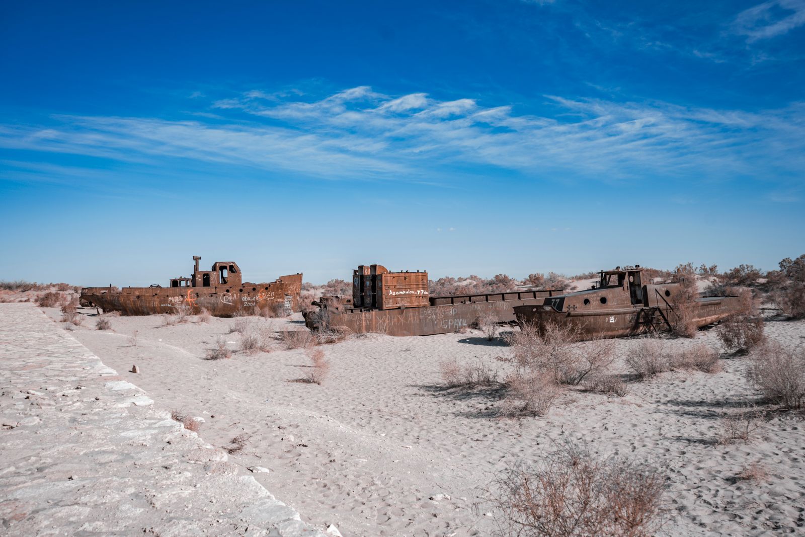
The Aral Sea sat between Kazakhstan and Uzbekistan and covered roughly 68,000 square kilometres in 1960, ranked as the fourth largest lake on Earth, fed by snowmelt funnelled down two rivers — the Syr Darya from the Tien Shan and the Amu Darya from the Pamirs. Then Soviet engineers cut the arteries. Canals pulled the rivers sideways into cotton fields across the Kyzylkum and Karakum deserts, and the lake, no longer receiving what evaporated off its surface, began to retreat from its own shoreline at a rate that turned fishing ports into inland towns marooned 100 kilometres from water.
Fifty years later, NASA satellite imagery shows the lake had collapsed to roughly 10 percent of its 1960 extent, and the exposed bed — a salt-crusted plain now called the Aralkum — spans tens of thousands of square kilometres. But the northern lobe, sealed off from the dying south by a Kazakh dam completed in 2005, has been rising. The story of why one half is coming back and the other half is emitting carbon like a mid-sized European country runs through cotton policy, hydrology, and a single concrete wall called Kok-Aral.

What the diversion actually did
The Syr Darya and Amu Darya are long rivers. The Amu runs about 2,400 kilometres from the Pamirs; the Syr about 2,200 from the Tien Shan. Together they delivered somewhere in the order of 55 cubic kilometres of water per year into the Aral basin in the mid-twentieth century. That was the entire input. The Aral has no outlet — it is a terminal lake, meaning water leaves only by evaporating off the top.
Starting in the 1950s and accelerating through the 1960s, Soviet planners diverted both rivers into an expanding grid of unlined earthen canals to irrigate cotton across Uzbekistan and Turkmenistan. The United Nations and multiple regional bodies have since documented what followed. The Karakum Canal alone, the longest of the diversions, stretched more than 1,300 kilometres and lost enormous volumes to seepage and evaporation before the water ever reached a field.
By the late 1980s, the Aral had split into a northern lobe (the Small Aral, in Kazakhstan) and a southern lobe (the Large Aral, mostly in Uzbekistan). By 2014, the eastern basin of the Large Aral had gone dry for the first time in roughly 600 years.
The shoreline as a carbon timeline
Because the sea retreated in stages, the exposed lakebed reads like a set of tree rings. Areas closest to the original 1960 shore have been dry for six decades. Areas near the current puddles of the South Aral were still underwater within the past few years. A recent expedition sampled sediment along this gradient.
The team found that a dried lakebed is not a neutral surface. It is a chimney. Organic carbon that had accumulated on the lake floor for centuries — plankton, algae, plant matter settling into anoxic mud — begins to oxidise the moment it meets air. Between 1960 and 2022, the Aral Sea released massive amounts of carbon dioxide into the atmosphere — comparable to multiple years of a mid-sized European country’s emissions.
About half of that flux happens in the first 15 years after a patch of lakebed dries out. Then it decays slowly. Nearly a fifth of the total came not from the ground breathing out, but from wind lifting sediment away entirely — the same wind that carries salt and pesticide residue across former fishing villages like Muynak.
Large amounts of carbon dioxide remain locked in the top layers of Aralkum sediment, waiting to oxidise. Cores capped at 50 centimetres — the deepest light-duty equipment could reach — show substantial carbon reserves, and the lakebed extends much deeper than that. The real number could be larger. If restoring water to portions of the former lakebed could keep even a fraction of that carbon buried, the climate benefit would be substantial. Terminal lake drying represents a significant blind spot in climate accounting that researchers are only now beginning to quantify.
Why the north is coming back
The Small Aral, the northern lobe, has a different fate because Kazakhstan built a barrier. The Kok-Aral Dam, completed in 2005, is an earth-and-concrete embankment across the narrow channel that once connected the northern and southern lobes. Its job is simple: keep every drop of Syr Darya water that reaches the north from spilling south into a basin that is, at this point, essentially unrecoverable.
The effect was faster than engineers projected. Water levels in the Small Aral rose several metres within a few years. Salinity dropped. Commercial fisheries — pike-perch, flounder, bream — returned to Aralsk, a port that had been stranded 100 kilometres from any water in the 1990s. By the late 2010s, catches from the northern lobe were being trucked to processing plants that had sat idle for a generation.
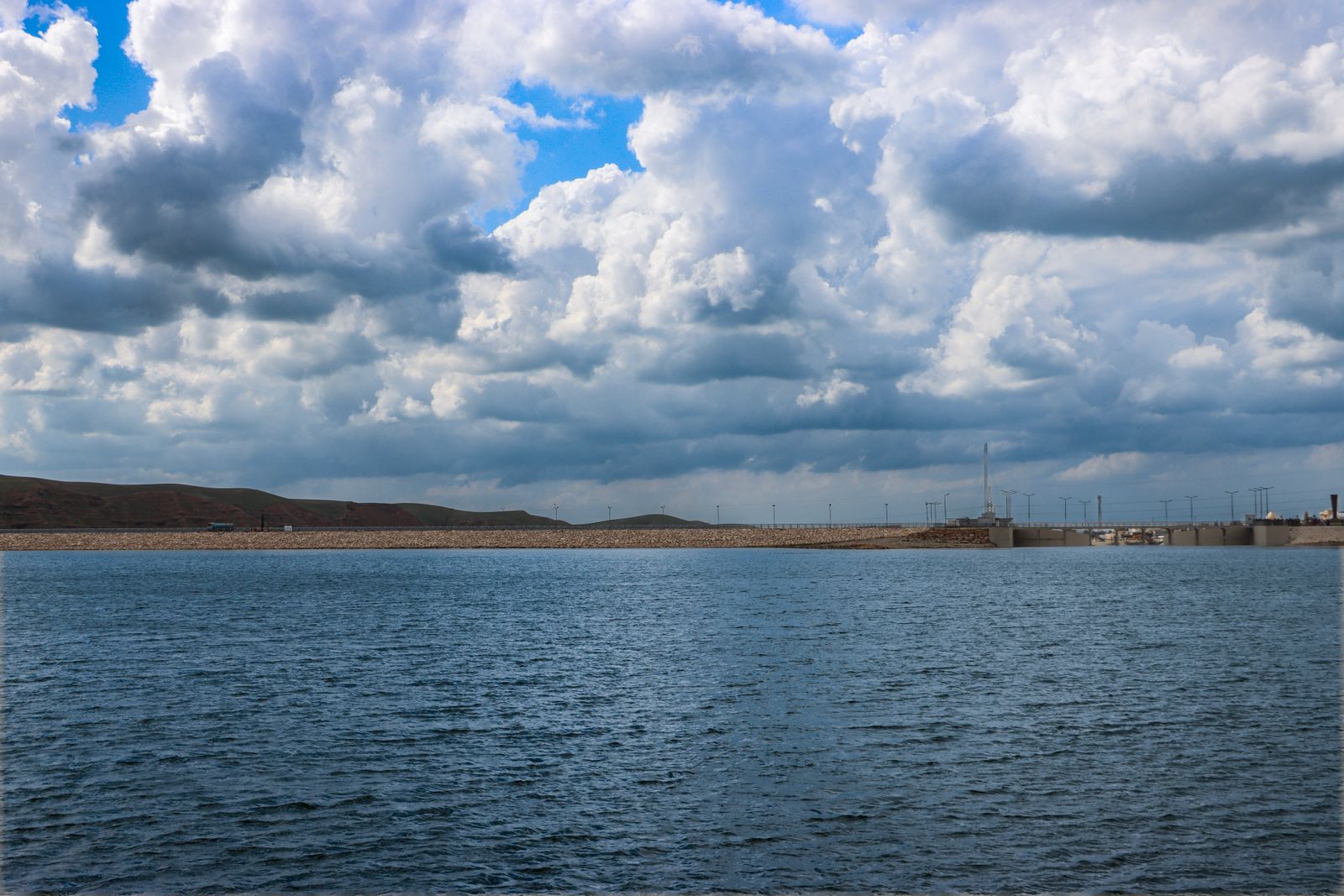
The rebound is partial. The Small Aral is still a fraction of the original northern basin, and the shore is still kilometres from where it used to be. But the trajectory is upward, not downward, and Kazakhstan has floated a second phase of the dam that would raise the retaining wall further and push water back toward Aralsk itself.
Why the south cannot follow
The southern lobe sits mostly in Uzbekistan, which depends heavily on the Amu Darya for the cotton economy that the Soviet diversions were built to serve. Getting meaningful volumes of water back to the South Aral would require Uzbekistan and Turkmenistan to consume dramatically less along the Amu — a shift that would touch millions of livelihoods and a national export sector.
The physical geometry also works against recovery. The South Aral is broader and shallower than the north, meaning evaporation losses per unit volume are higher. Salinity in the residual pools is now so extreme — over 100 grams per litre in places, more than three times as salty as ocean water — that the ecosystem that existed there in 1960 cannot simply be rehydrated back into place.
National Geographic’s reporting on regional restoration efforts has traced the various proposals — pumping Caspian water, redirecting Siberian rivers, terracing the exposed bed to slow dust — and concluded that restoring the South Aral at anything like its former volume is not on any realistic near-term timeline.
The dust, the salt, and the health cost
What the Aral left behind is not sand. It is a fine crust of salt, gypsum, and residual agricultural chemicals — decades of pesticide and fertiliser runoff that flowed down the rivers and settled to the bottom. When wind lifts that crust, it carries the mixture across Karakalpakstan, the Uzbek autonomous republic on the southern shore. Rates of respiratory disease, anaemia, and certain cancers in the region run well above national averages. Winters in the region are colder and summers hotter than they were before the sea shrank, because a large body of water buffers temperature swings, and that buffer is gone.
The Aralkum Desert, as the exposed bed is now formally called, is the youngest desert on Earth. It did not exist before 1960. It is being studied as a case example of what happens when a terminal lake dies within a single human lifetime. Solar Daily has previously covered how Landsat satellites documented the desiccation over decades.
The wider pattern
The Aral is the most extreme case, but it is not unique. Lake Chad in the Sahel has lost roughly 90 percent of its 1960s surface area. Bolivia’s Lake Poopó, once the country’s second largest lake, essentially disappeared in 2015 and has only partially returned. The Salton Sea in California is shrinking and exposing sediment laced with agricultural runoff. The Caspian Sea, the world’s largest inland body of water, is projected to shrink by more than the entire original area of the Aral by 2100.
Each of these is a terminal or near-terminal basin where inflow has fallen below evaporation. Each is releasing carbon that had been sequestered underwater. And each has, buried in its geometry, some equivalent of the Kok-Aral question: is there a section that can be walled off and saved, even if the whole cannot?
Solar Daily has previously looked at how cross-border coordination shapes climate outcomes, and the Aral is a textbook case of the same problem at basin scale — the Syr Darya passes through four countries before it reaches what is left of the northern lobe. Related reporting on carbon sinks under stress shows the same accounting blind spots appearing elsewhere.
What the northern rebound actually proves
The Small Aral is not a full recovery. Fishing yields are a fraction of what the whole sea supported in the 1950s. The southern basin is still functionally lost. But the north demonstrates a specific claim: given a physical barrier and a single river’s flow, a terminal lake can be partly reconstituted within a decade. Salinity drops. Fish return. The lakebed stops emitting.
That is the finding underneath the satellite images. A body of water that shrank to a tenth of its volume across sixty years was not a single system dying evenly. It was two lobes with two futures, separated by a channel that Kazakhstan closed with a dam in 2005. One lobe kept dying. The other started coming back the year the concrete set.
The town of Aralsk still sits kilometres from the water. But the water is closer than it was in 2004, and the boats in its harbour — grounded for so long they had become monuments — are, in some cases, being repaired.